Walking MacRitchie
Finally managed to get ourselves up and about early one Saturday morning for a long overdue walk around MacRitchie reservoir. We knew we'd never make it if it was just the two of us... luckily Donabel and Mia showed up to provide some much needed incentive.
There are several trails to choose from. Route 4 (orange on this map), which we took, is roughly 12 km. It circles the reservoir and a good chunk of forest, with a stretch of golf course thrown in for good measure. The walk was pleasant and not too difficult if you’re in shape. You'll be sore the next day though if you aren't used to walking! Lots of people jogging, a few were walking (like us). At our pace the walk took about 3 1/2 hours. Trails are well marked and there are maps at major junctions.
Monkeys hang out on some sections of the trail. They usually scatter when people approach, but if they just sit there watching you and you’re too scared to pass, grab a nearby dead branch and use it to wave them away. There are also lots of turtles in the water and on the banks sunning themselves.
We started off at the Thomson Road bus stop, just where Thomson curves into Upper Thomson. From here we proceeded to our left and followed route 4. In hindsight, we probably should have gone in the other direction because the HSBC treetop walk on Peirce Track is one-way (Peirce Track to Petaling Trail) – that added a couple of kilometers to our circuit, and by that time we were pretty tired.
Mia jogs regularly at MacRitchie and knew all the best routes, so all we did was follow her! 2 km before the end of the trail, John got tired of waiting for us fitness-challenged girls and decided to run the rest of the way.
Bring lots of cold water as drinking fountains seemed few and far between. An enterprising Filipino guy was selling cold drinks along Island Club road... smart. And wear a hat – the sun can really beat down on you when you reach the golf course section of the trail.
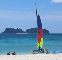
Next time I’ll try kayaking. The Singapore Canoe Federation rents out kayaks and gives classes at the reservoir.
Getting there
Buses 74, 93, 130, 132, 156, 157, 162, 165, 166, 167, 605, 852, 855 and 980 all go to Macritchie reservoir (get off at Lornie Road / where Thomson Road turns right and becomes Upper Thomson Road).
post this to del.icio.us
posted by C @ 8:04 PM
permanent link
3 comments
![]()


3 Comments:
I had a very similar experience at MacRitchie almost exactly a month later. Really enjoying your blog.
MacRitchie is a great place for walking. One of our next goals is to walk from MacRitchie to Bukit Timah (2 hours at a brisk walking pace, probably 3+ hours at a more relaxed pace).
Glad you liked the blog!
Cheers,
Ching
Hi,
I am a fan of McRitchie trail and was glad to read your note. It provides long walking trails. I felt it was a good work-out for guys strapped to desk and a pleasant change from well maintained "garden" kind of walk.
Interestingly, I found out some minor entry points into McRitchie on Lornie road from where HSBC tree top is just a 3-km walk.
Btw, I tried walking upto Bukit Timah Reserve only to find myself disappointed. The path is not well marked at some points after Julotong Tower. After a point, it leads you into a vehicular road and that stretch is absolutely lonely with no soul as far as eyes can see. I didn't enjoy the walk from McRitchie to Bukit Timah.
Post a Comment
<< Home