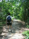
Walking From MacRitchie to Bukit Timah
We spent Singapore's National Day walking from MacRitchie Reservoir to Bukit Timah, breaking in the new Montrail boots we bought from Camper's Corner (which is an excellent shop, by the way).
This was our second attempt to follow the brisk walk route posted by the NUS Habitat group. And unsuccessful again, I might add. We keep missing a turn on Rifle Range Road, and ending up at the Bukit Timah Visitor Centre instead of on Catchment Path to the Bukit Timah summit. This time I'd built up some endurance and had enough energy to walk up to the summit of Bukit Timah, instead of copping out and heading straight for the restaurants nearby.
The walk took us about 3 hours, including the visit to Bukit Timah's summit (which is Singapore's highest point, at the grand elevation of 166 meters).

Route:
1. We start off at the MacRitchie reservoir bus stop, where Thomson Road turns right to Upper Thomson. Walk past the car park to the start of Lornie Trail. Take a look at the MacRitchie map for details. Lornie trail is the yellow trail, Rifle Range Link is the pink one.
2. Follow Lornie Trail past the golf course and Jelutong tower.
3. Continue past Jelutong tower. You'll see a fork in the path, with the right fork going to Sime Trail (and the HSBC treetop walk), and the path straight ahead continuing on to Rifle Range Link. Take the route to Rifle Range Link.
4. Eventually you'll reach what appears to be a dead end at the end of Rifle Range Link. The wooden sign to Bukit Timah Nature Reserve points diagonally away from the Rifle Range Link trail; the path goes up a short but steep slope is and apparently blocked by a green metal railing. Just step over the railing and continue on. The pink trail markers will continue on the other side of the railing.
5. Keep following the pink trail markers. Eventually you'll reach Rifle Range Road. Follow the road until it crosses Bukit Timah Expressway.
6. This is where we diverge from the NUS Habitat Group's brisk walk route, somehow. We kept walking down Rifle Range Road until we saw clearly marked trail signs. You have two options: the first one, 100-200m longer, is take the first trail to the left, leaving Rifle Range road at the sign marked "Kampong Trail". Bring a copy of the Bukit Timah map, or look at the map signs posted along the trail. The Bukit Timah Visitor Centre is 2.2 km from the point where you leave Rifle Range Road to head for Kampong Trail.
7. The second option, which we took this time around, was to continue walking down Rifle Range road all the way until Kampong Trail crosses Rifle Range Road. At that point you can turn right onto Kampong Trail and continue following the pink trail markers (and the most well-worn trail). Whenever you see a sign pointing to "Bukit Timah Visitor Centre", follow it. Eventually you'll emerge onto Hindhede Drive. Civilization!
From there you can turn right to the Vistor Centre; or turn left, walk out to the main road, cross, and eat at Boon Tong Kee just down the street from Courts.
post this to del.icio.us


3 Comments:
Thanks for the detailed description given here. We are planning to go for this trek and we needed such details.
Thanks for sharing. I'm doing this now!
But the brisk walk route did not to visitor center but from rifle range across Lasia valley up catchment path. You did not go up to the top?
Post a Comment
<< Home